Rebuilding forest resilience
in a fire-ravaged landscape

South Central Oregon
Integrated Post-Fire Resilience Strategy


scroll

i Image: Jade Elhardt

High severity fire is on the rise in the Pacific Northwest.

Increasingly frequent and severe wildfires are scorching western forests. The sheer scale of fire combined with a hotter, drier climate is degrading forest health and inhibiting natural regrowth.

South Central Oregon is no exception. Between 2018 and 2021, multiple blazes burned nearly 660,000 acres—about 15 times the size of Washington, DC.

Image: Fremont-Winema National Forest / Flickr.

Public and private landowners have come together to lay out a path for recovery.

Major partners in the region are uniting behind a groundbreaking cross-jurisdictional approach to restore resilient forests in Oregon's Klamath and Lake counties. The resulting strategy has become a national blueprint for post-wildfire recovery.

Image: U.S. Forest Service / Flickr.

Six large fires burned across Lake and Klamath counties between 2018 and 2021.

Forests have become more flammable. Warmer, drier conditions; fire suppression policies; and the suspension of indigenous fire practices have fueled more severe fires, capable of destroying mature and old growth forests and their crucial seed stocks.

Inset image: Fremont-Winema National Forest / Flickr. Map: Julia Twichell / American Forests.

These wildfires know no boundaries.

The flames blistered across approximately 660,000 acres of lands managed by the Fremont-Winema National Forest, Bureau of Land Management, tribes and nonprofits, as well as private forests and industrial timber lands.

Inset image: Marcus Kauffman / Oregon Dept. of Forestry. Map: Julia Twichell / American Forests.

Nearly two-thirds of the forest lost 75% or more live tree cover due to high severity fire1—an area ten times the size of Washington, DC.

In large patches burned at high severity, forests' ability to regrow can be severely delayed or even permanently halted. Shrubs grow up quickly, creating fuel for fires and leaving areas vulnerable to reburns.

hover to see more  

1High severity fire is measured by 75% or greater forest cover loss, quantified as basal area mortality.

Map: Julia Twichell / American Forests.

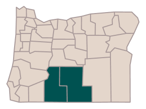
South central Oregon is pioneering a strategy for bolstering forest resilience to wildfire and climate change.

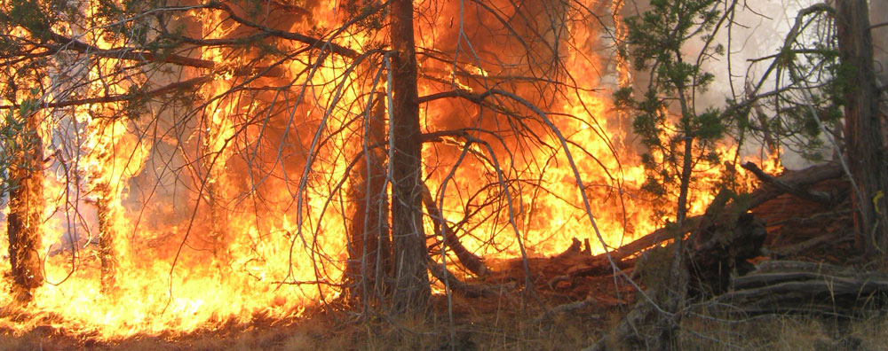
How? In the short term, land managers will reduce the shrubs, dead wood and other fuels that feed severe reburns. They will also accelerate forest recovery by establishing disease- and drought-resilient seedlings.

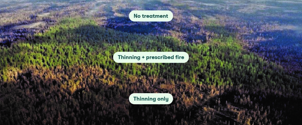
Once the forest is stable, they will control fuel levels through widespread application of low-intensity fire.

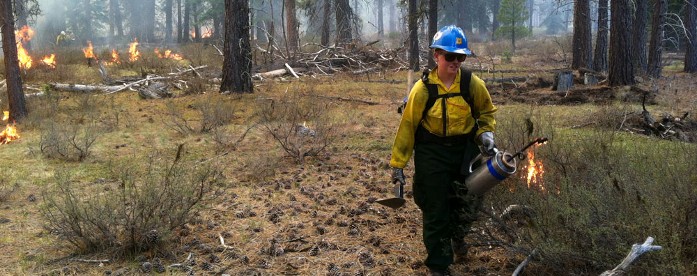
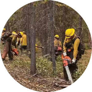
Image: Jade Elhardt.

A team of experts conducted a highly detailed geospatial analysis of the massive fire footprints.

By analyzing fuel loads, seed sources, burn contiguity, vegetation type and forest mortality, the team estimated the scale of need for different restoration treatments.

Inset image: Steve Rondeau / Klamath Tribes Natural Resources Department. Map: Julia Twichell / American Forests.

The team pinpointed areas where replanting and fuel control can facilitate recovery.

In areas with extensive forest loss, trees can regrow naturally only where seeds from surviving trees can disperse. By identifying areas located too far from seed sources, the team determined where planting seedlings can expedite reforestation.

Meanwhile, assessment of shrubs, dead wood and other fuels indicated where fuel control tactics could minimize the risk of severe reburns.

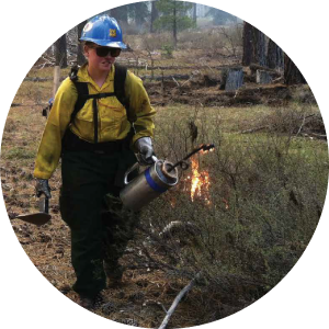
Inset image: Libby Pansing / American Forests. Map: Julia Twichell / American Forests.

The result? A full breakdown that estimates the scale and cost of activities needed to treat and restore all sections of the fire footprint.

250,000 acres
reforestation
(natural
and planted)

92,000 acres
meadow
restoration and
fuel reduction

203,000 acres
fuel treatment
without
reforestation

33,000 acres
prescribed fire
and other
maintenance

hover to see more

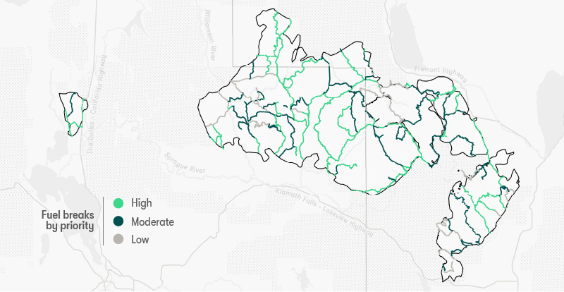
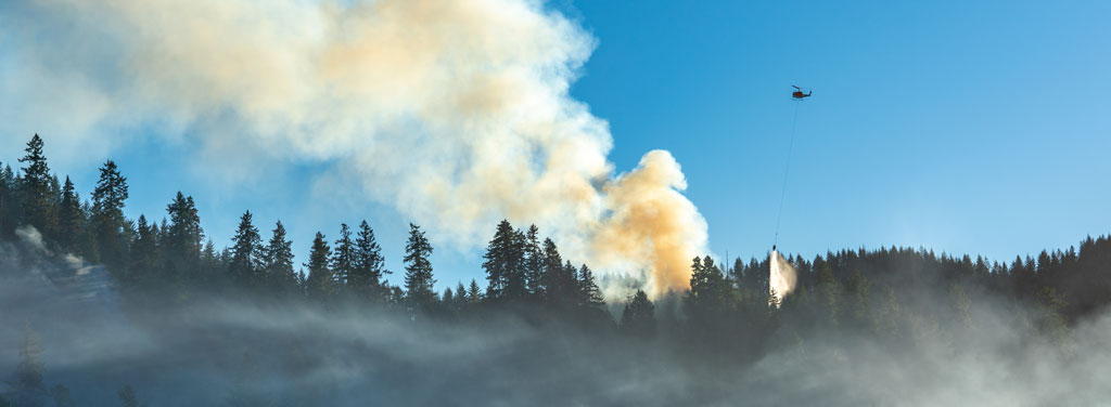
The team also mapped 586 miles of fuel breaks, proposing a network of corridors for firefighters that would also facilitate use of prescribed fire.

Maintaining cleared corridors provides access routes for firefighters and facilitates the safe use of prescribed fire. This proposed network of fuel breaks aligns with roads and areas already cleared by fire.

Background image: Fremont-Winema National Forest / Flickr. Inset map: Julia Twichell / American Forests.

Recognizing the vast workload ahead, partners have adopted a methodical prioritization strategy.

In this landscape, reforestation becomes more expensive and difficult as time passes after a wildfire. A triage system in the strategy identifies high priority areas where reestablishing forests quickly can increase seedling survival and prevent permanent conversion to shrubland.

hover to see more

Map: Julia Twichell / American Forests.

The largest landowner, Fremont-Winema National Forest, will restore forests until they can be maintained by prescribed fire in the long term.

The national forest has identified 3,000-5,000-acre implementation units, within which fuel reduction and reforestation activities will take place. The units were prioritized based on the number of high- and moderate-priority acres.

Once fuel conditions are stabilized across an entire unit and regenerated trees are large enough, prescribed fire can be reintroduced as the primary management tool.

Inset image: U.S. Forest Service / Flickr. Map: Julia Twichell / American Forests.

More staff, funds and seeds are needed to restore the identified 200,000+ acres of public lands.

The Fremont-Winema National Forest has enough seed inventory to plant about 30,000 acres—roughly 15% of the acres that need replanting.1 At current staffing levels, it would take ten years to complete site planning alone and another fifty years to restore 70% of the affected acres.

The REPLANT Act opens up funding for the Forest Service to address its reforestation backlog. To meet the reforestation needs of the National Forest System, American Forests and partners are working to accelerate growth of the workforce and secure funds for restoration. In addition, American Forests is developing the Western State Seed Collaborative to ramp up seed collection.

  1Updated Jan 17, 2024.

Image: Jason Houston / American Forests.

This first-of-its-kind strategic approach to restoration in south central Oregon is a national model for post-fire restoration.

Strategies like this one can provide a baseline for understanding priorities, costs and resources needed—a framework to guide cross-jurisdictional collaboration across large landscapes. Information identified in planning can also be used to leverage public and private funding to support the scale of work needed and build capacity.

Read the full report.

South Central Oregon Integrated Post-Fire Resilience Strategy

Background image: Cecilio Ricardo / U.S. Forest Service.

High-severity fire is on the rise at an enormous scale. We need to act now to restore post-fire landscapes and prevent forest loss.

American Forests is working urgently to mobilize recovery and prevent the irreversible loss of western forests. The unprecedented federal commitment to wildfire recovery through the Inflation Reduction Act and bipartisan infrastructure law presents a unique opportunity to restore forests with greater resilience to wildfires and climate change, ensuring their long-term survival.

American Forests is proud to partner with the Forest Service on a comprehensive national keystone agreement focused on restoring national forests following severe wildfires. Over the next five years, we will work together to bring this post-fire resilience approach to other landscapes.


American Forests is here to help.

hover to see more

Background image: Libby Pansing / American Forests.

This strategy was prepared by American Forests in partnership with core team members from:

  • Pacific Northwest Regional Office, U.S. Forest Service
  • Green Diamond Resource Company
  • Collins Timber Company
  • Oregon Department of Forestry
  • Fremont-Winema National Forest
  • U.S. Forest Service Western Wildland Environmental Threat Assessment Center

Background image: U.S. Forest Service / Flickr.

The Klamath Tribes are the Klamath, Modoc and Yahooskin Paiute peoples, and are the first peoples of the land, having lived here since time immemorial.

The South Central Integrated Post-Fire Resilience Strategy was prepared by Elizabeth Pansing Ph.D., Brian Kittler, Austin Rempel, Brian Morris Ph.D. with guidance from the "Core Team"—individuals from partner organizations with long histories of management activity in Klamath and Lake counties—and the Klamath Tribes Natural Resources Department.

Story, visualizations and maps by Julia Twichell. Editing by Liane O'Neill.

2023 American Forests. All Rights Reserved.